Apple Maps has 12 new features in iOS 16 you need to know about
While the Maps app didn’t get as big of an update in iOS 16 as Books, Messages, Photos, and Weather, there are still some cool new features on your iPhone.
A new update to Apple Maps brings improvements to trip planning, public transportation information, accessibility features, walking directions, and places information, with a focus on certain cities and countries. Some of these updates may change slightly as iOS 16 is still in beta, but the core concept should remain when iOS 16 is released to everyone this fall.
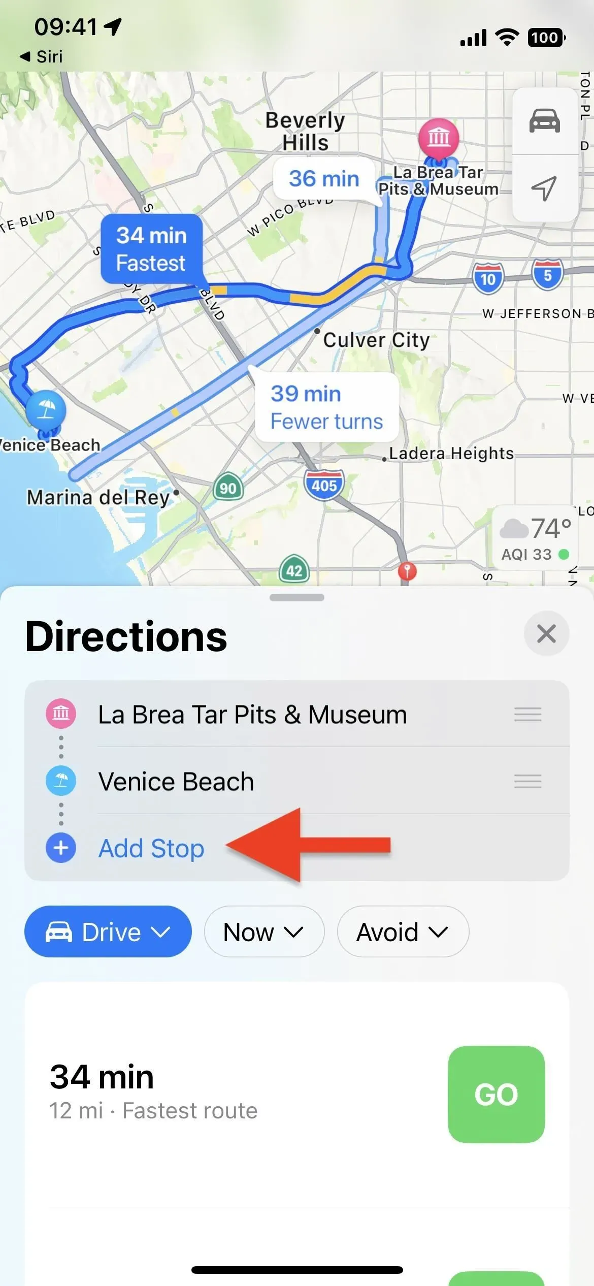
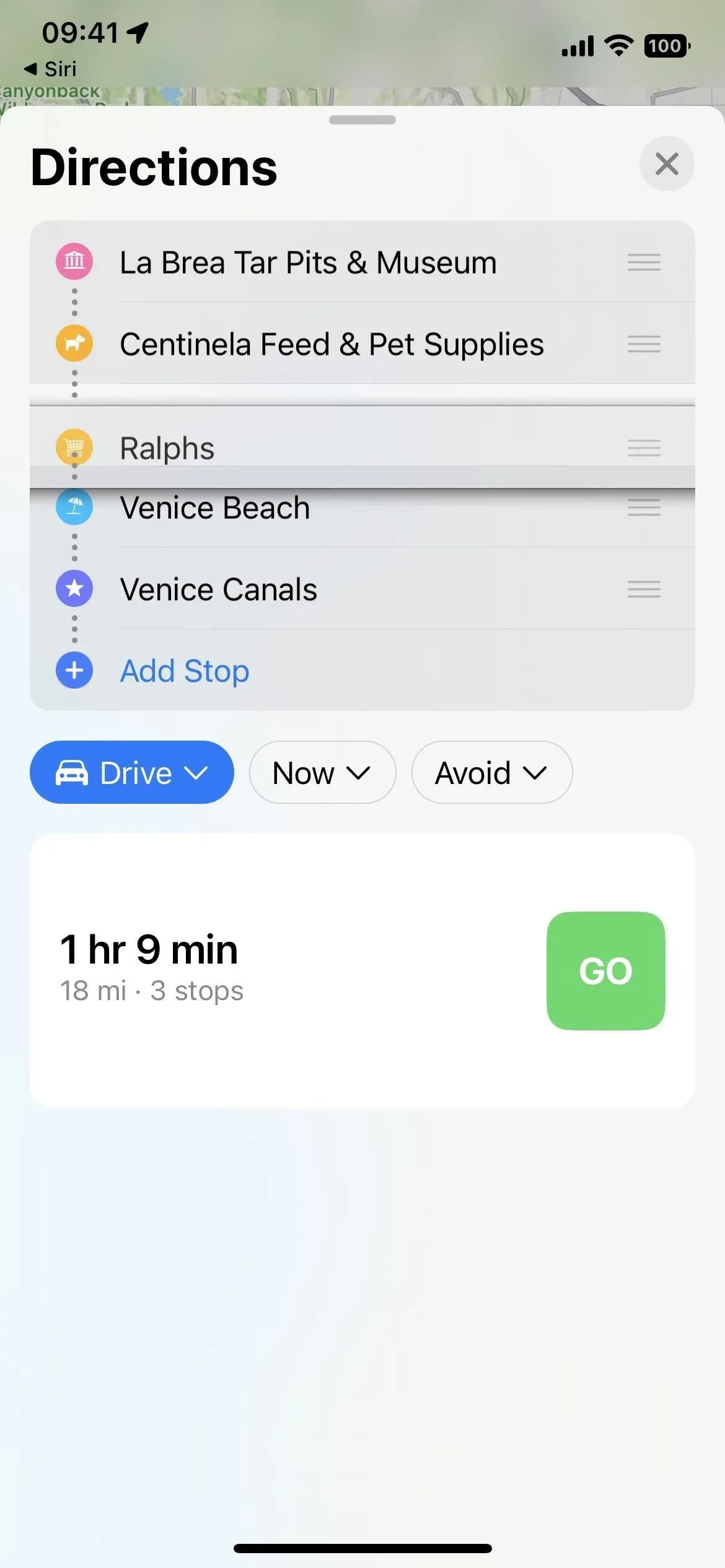
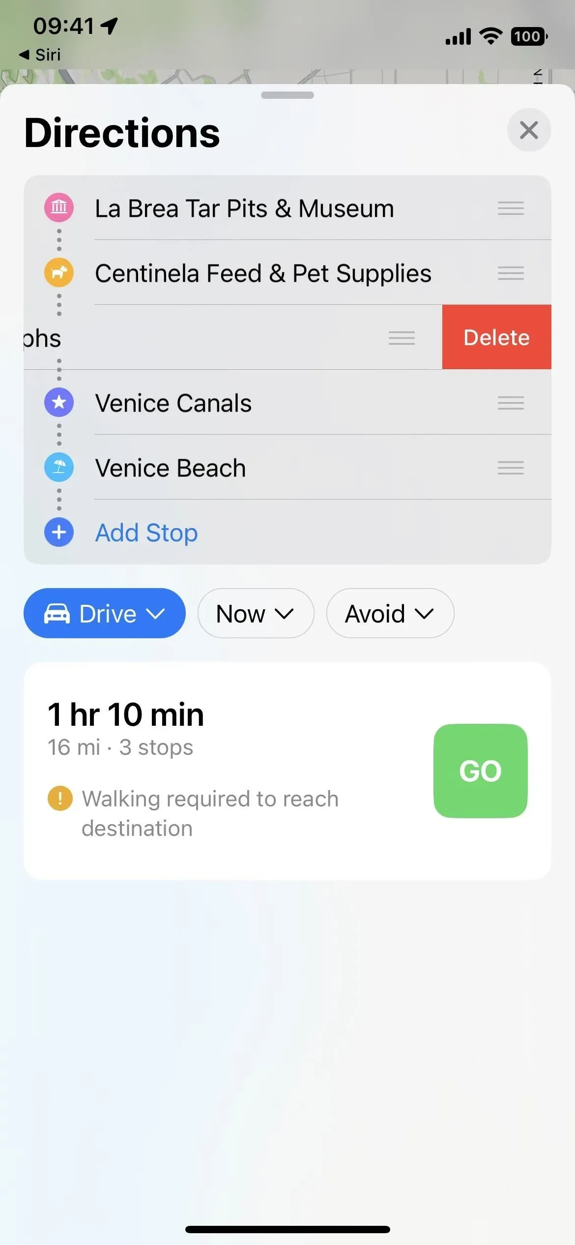
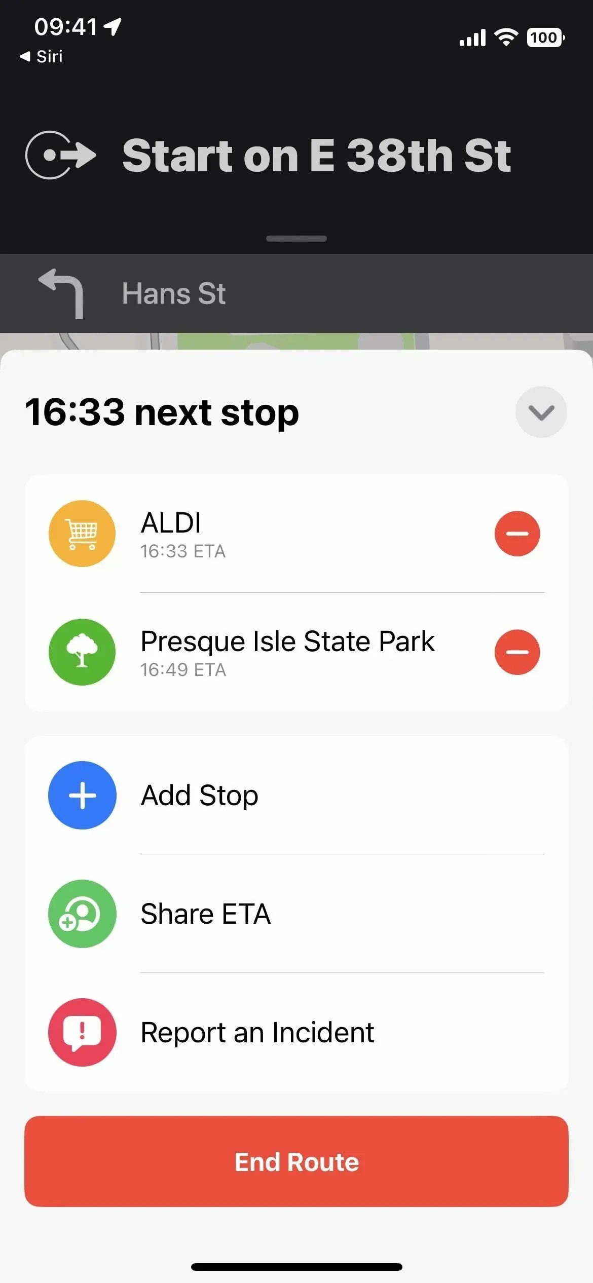
1. Plan routes with multiple stops
You can finally create a route with multiple stops in the Maps app. Previously, you could only add pit stops while navigating, and these could only be gas stations, cafes, fast food, parking lots, banks, and stores. Now you can plan and set each stop before you start your route.
Multi-stop routing is available on both iOS 16 and iPadOS 16, and even works on macOS 13 Ventura where you can plan a route and sync it to your iPhone.
Find and select your desired destination on Maps, then tap the driving directions icon on the dashboard to start planning your navigation. If you’re not starting from your current location, replace “My Location”with this. To create additional stops, click Add Stop and enter a different location.
You can add multiple stops during your trip – up to 15 in total – and rearrange their order by dragging each location from the three-line icon up or down to a different location. To remove stops you don’t need, swipe left on them. When you’re ready, click “Go”to start the route.
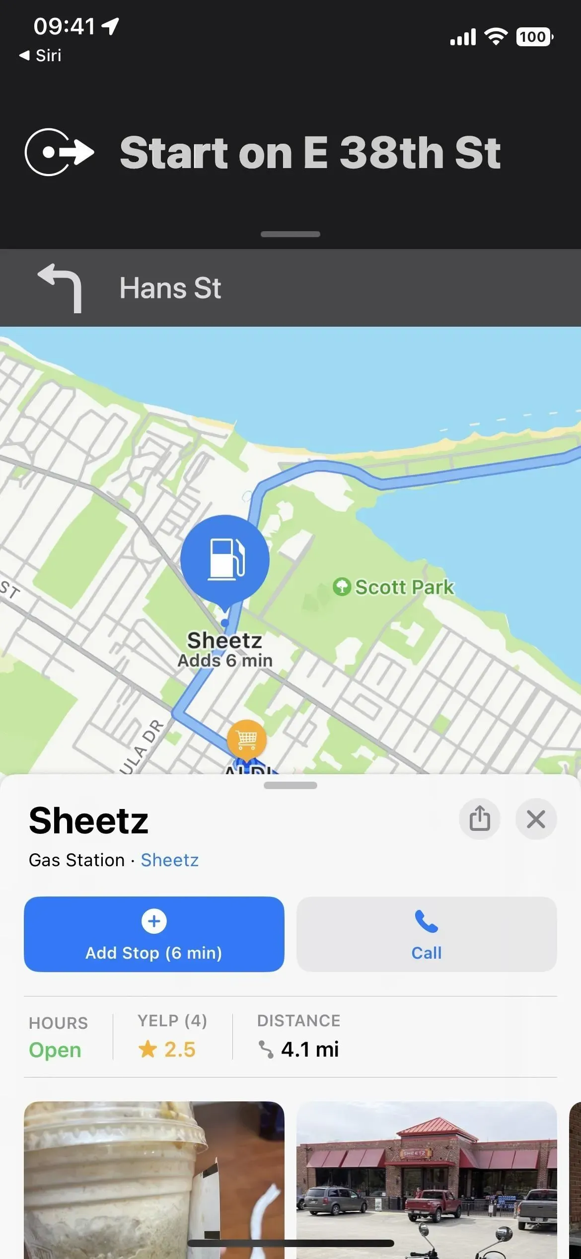
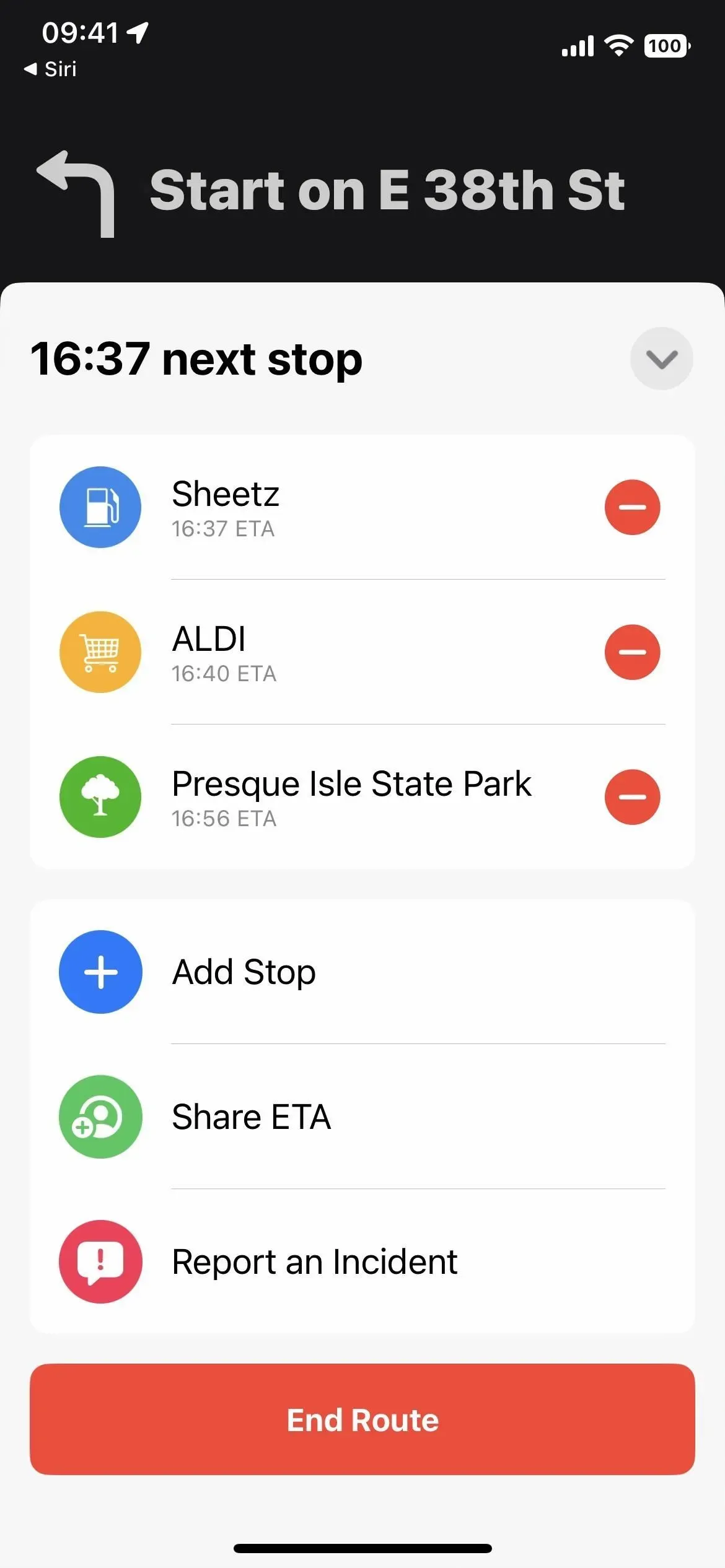
2. Add extra stops while navigating
Once you’ve started a multi-stop route, you can add more stops by clicking the arrow to expand the navigation map and clicking Add Stop. It’s like iOS 15, where you’ll see the same categories of pit stops, but now there’s also a search bar to enter any address you want.
You can also ask Siri to add stops while driving. Siri will offer options to choose from. Tap the option you want, then tap the driving direction icon on the details card. It will show location information in the Maps app, and you can tap Add Stop to include it on your current route.
Tap the minus sign next to stops on the navigation map to remove them. Unlike the original trip planning, you can’t change the order of stops when routes are active, and any new stop you add will be the next place Maps takes you.
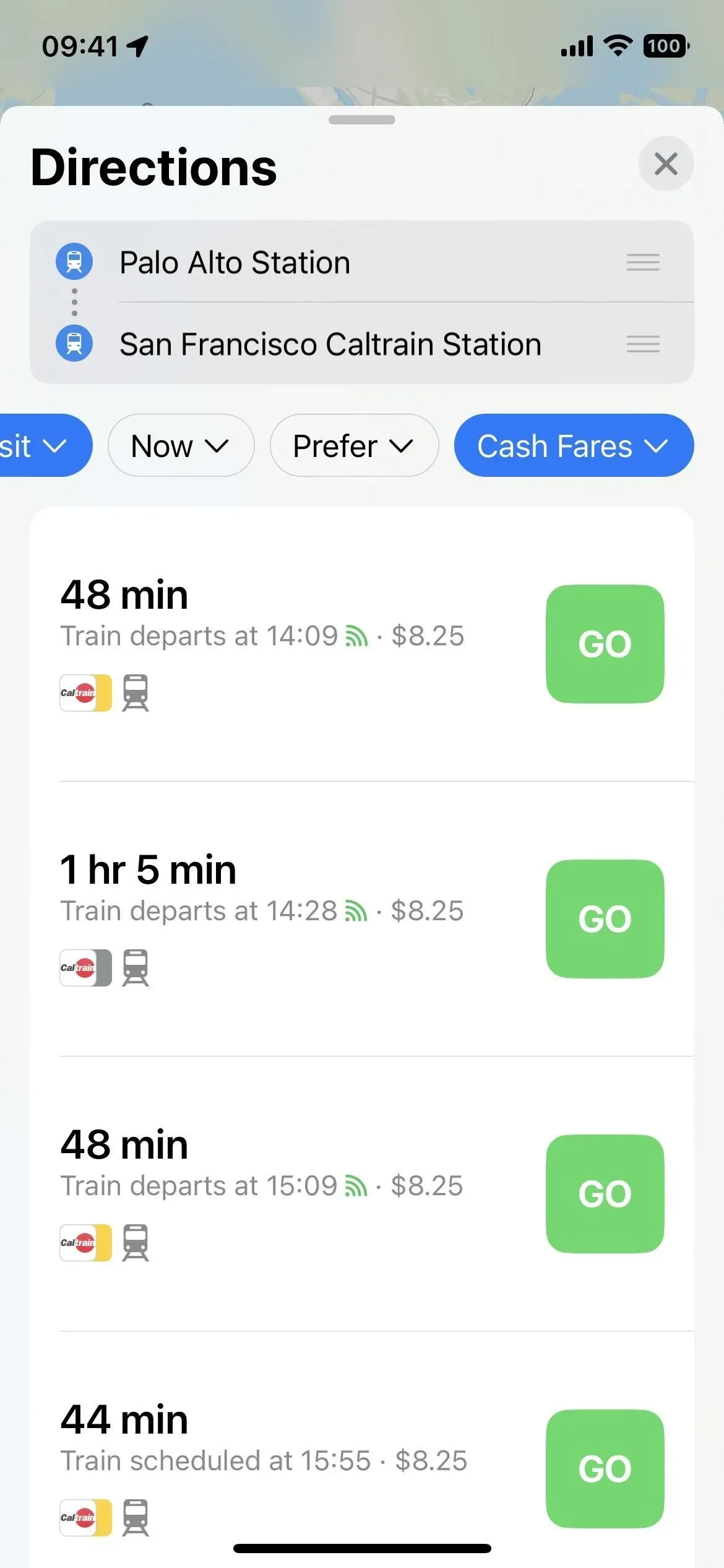
3. View fares when planning your trip
New fares allow you to calculate the cost of a trip when using public transport. Enter a start and end point, then click Directions. If “Transport”isn’t selected in the new drop-down menu that replaces the buttons for each mode of transport that were there before, change it to Drive, Walk, Bike, or Ride.
If Maps has access to your area’s public transit fares, you’ll see a new “Pass Fares”drop-down list to the right of “Preferred”as well as the total fare for each route option. Click “Card Fares”and you can switch to “Cash Fares”.
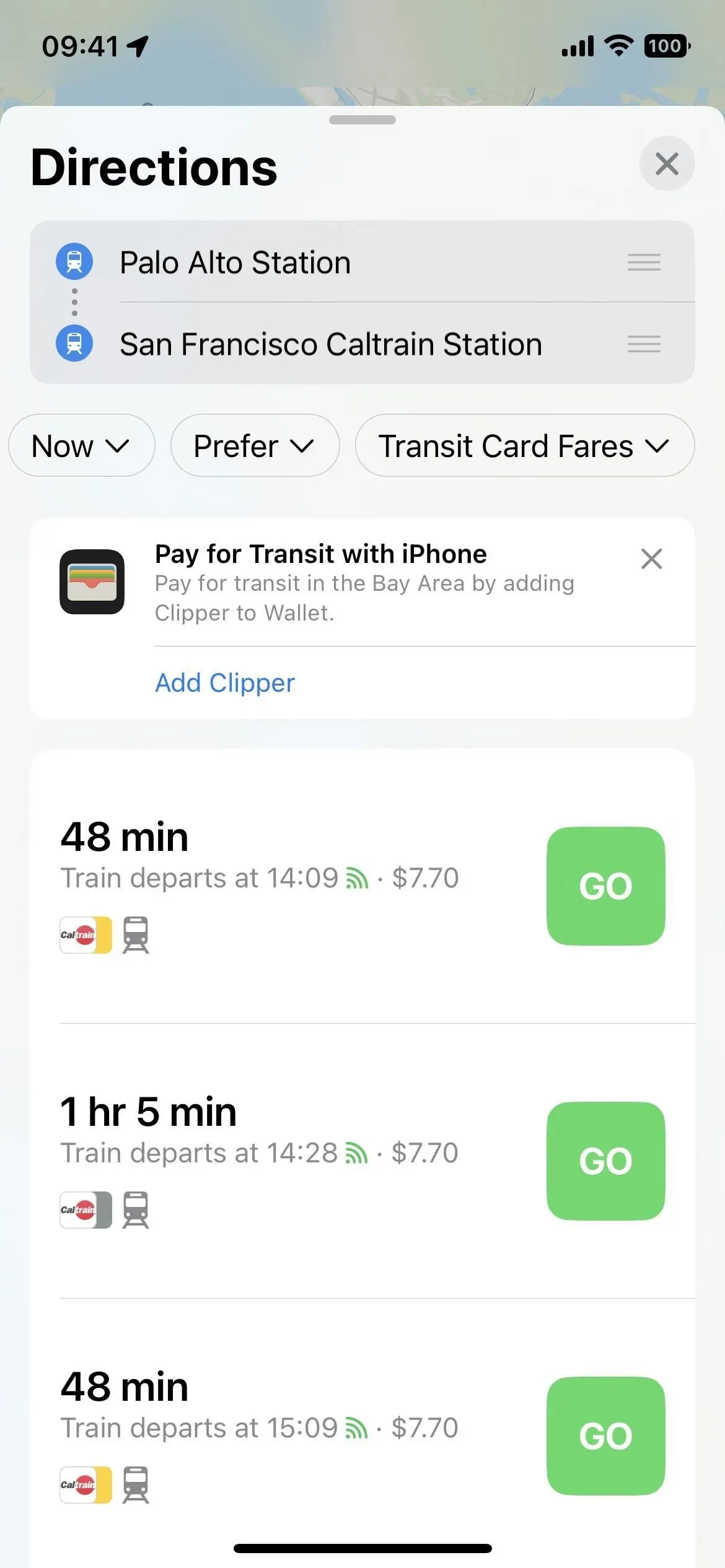
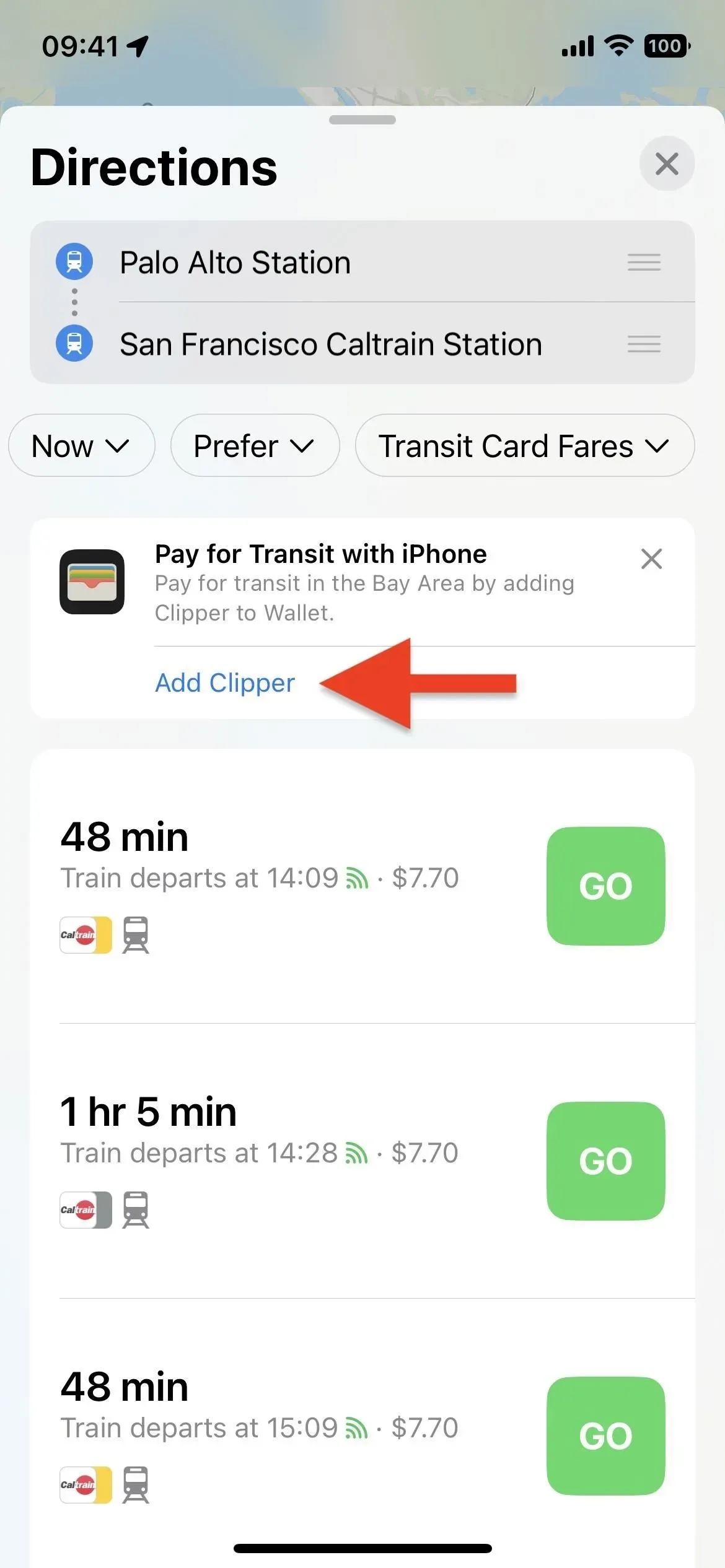
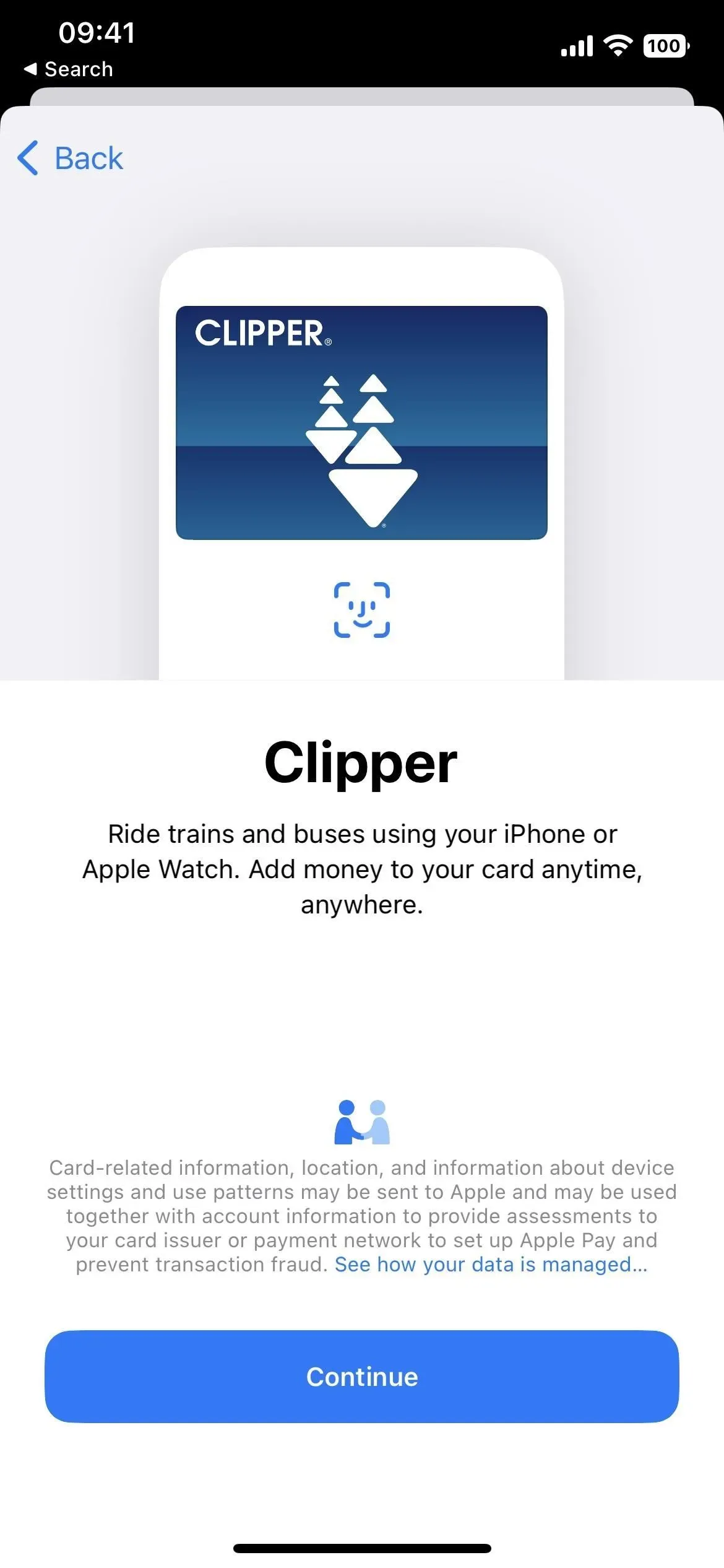
4. Add transport cards to your wallet
While you’ve already been able to add your transit cards for participating transit systems directly to the Apple Wallet app, you can now do so from the Maps app. When you get directions, you may see the prompt “Pay with iPhone”, and below are more details about the type of pass available. Click “Add [transport name]”and it should go straight to adding the service to Wallet.
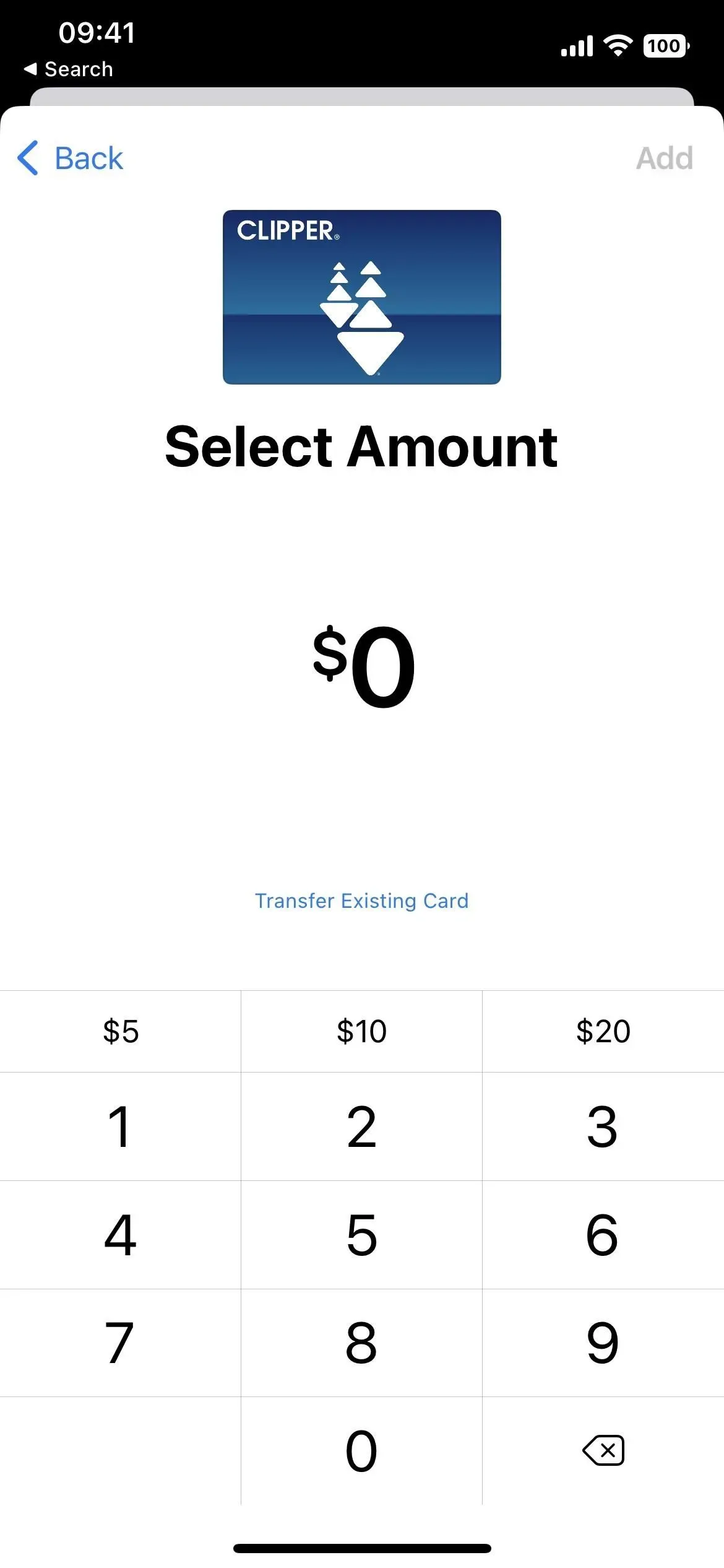
5. View and reload transport balances
In addition to adding a transit card to Wallet from Apple Maps, you can now view your transit card balance in the Maps app and top up your balance from there.
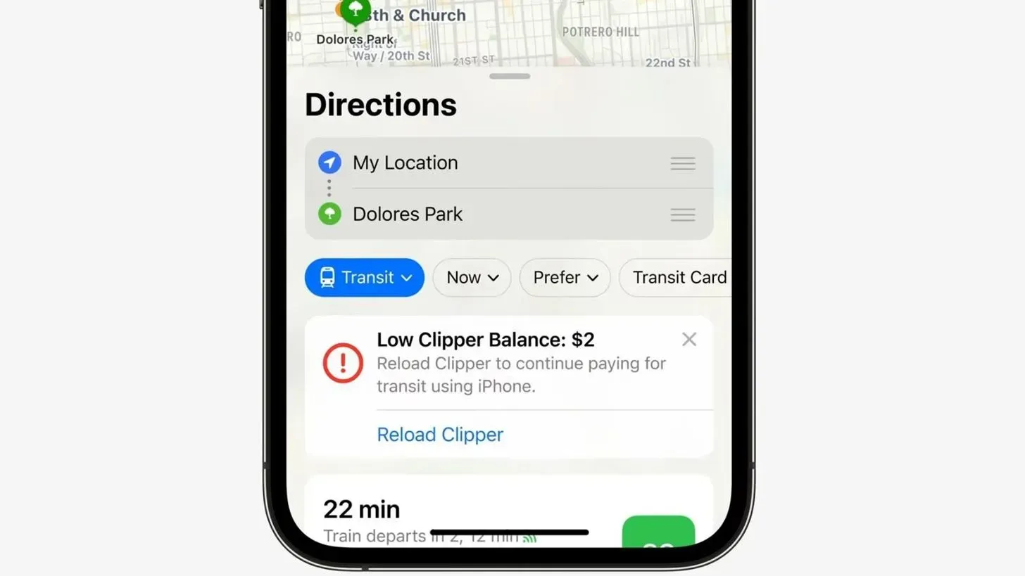
Image via Apple
6. VoiceOver Can Determine Starting Points
If you need to use VoiceOver with your iPhone (not to be confused with voice control), it can now help you more in Apple Maps. VoiceOver notifies you with audio and haptic feedback when you reach the starting point of the walking routes.
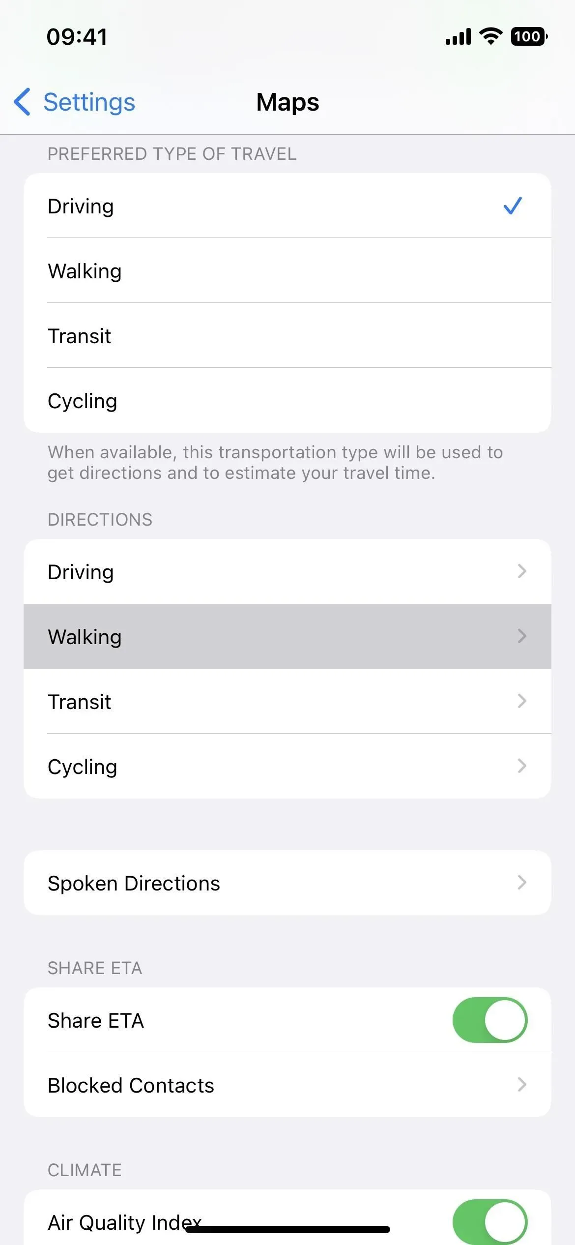
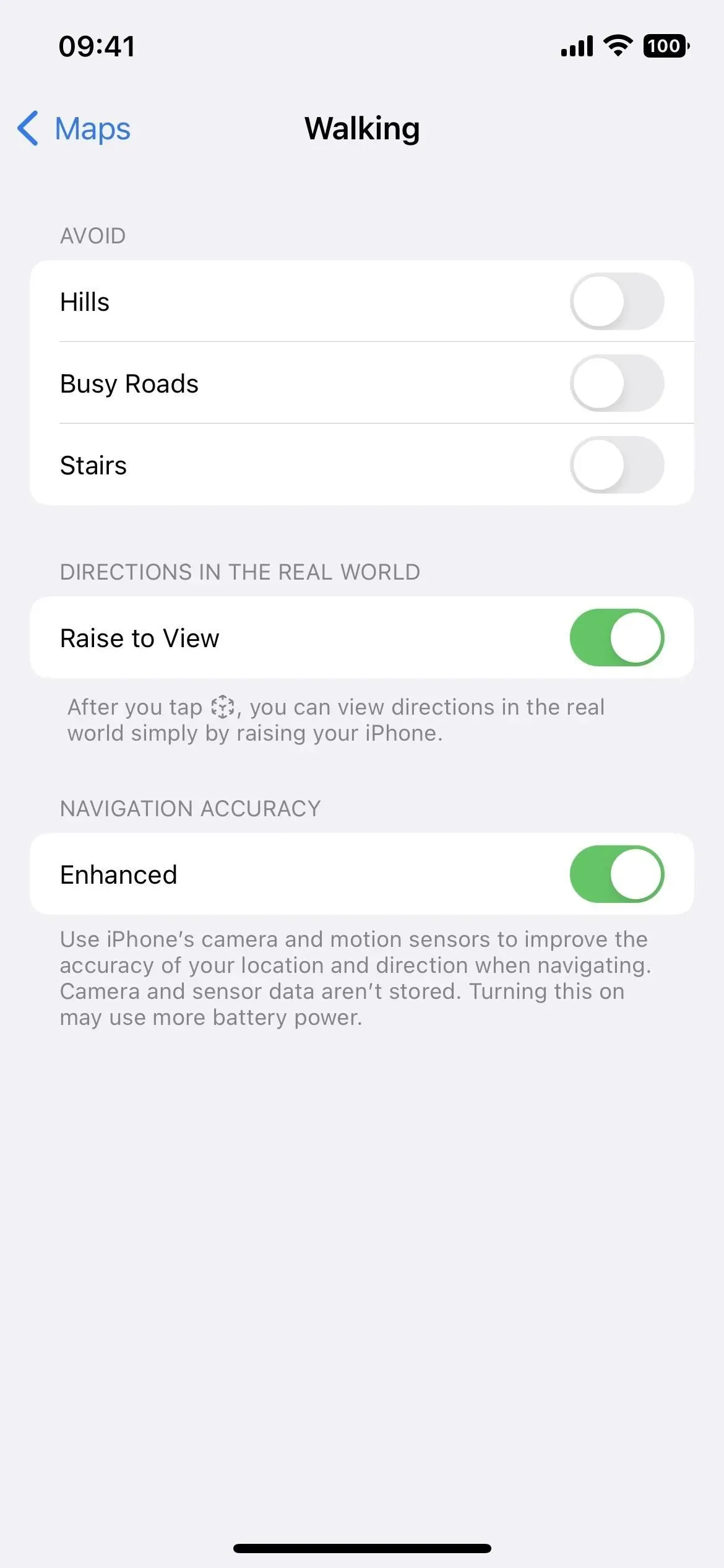
7. Avoid hills, busy roads and stairs when walking.
Previously, you could avoid toll roads and highways as driving directions, and hills and busy roads as bike routes, which still apply in iOS 16. In addition, you can now specify walking routes to avoid hills, busy roads, and stairs, be too dangerous or stressful for some users. You can set them via Settings -> Maps -> Walking.
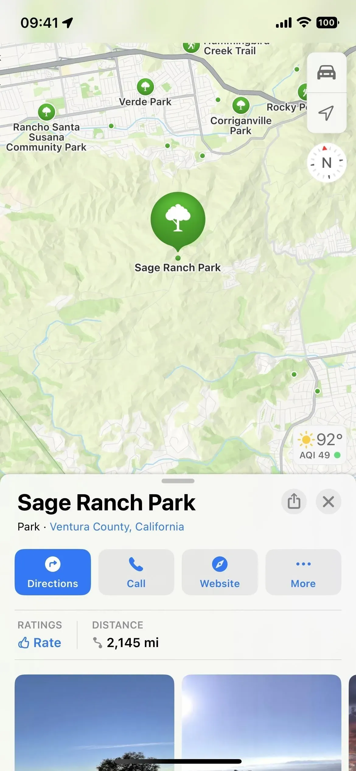
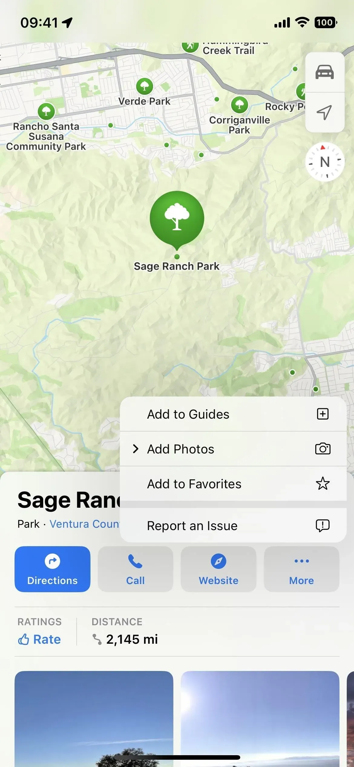
8. Access Quick Links to Places Faster
When you view location information in Maps on iOS 15, you will see a large direction button with an ellipsis (•••) button next to it, and you need to scroll down to see buttons to call a business, view your website, add it to the manual and upload the photos. In iOS 16, the call and website buttons are next to the driving directions button, and the More menu has a link to add the location to guides and upload photos. The share icon is also immediately visible instead of being hidden behind a scroll.
.
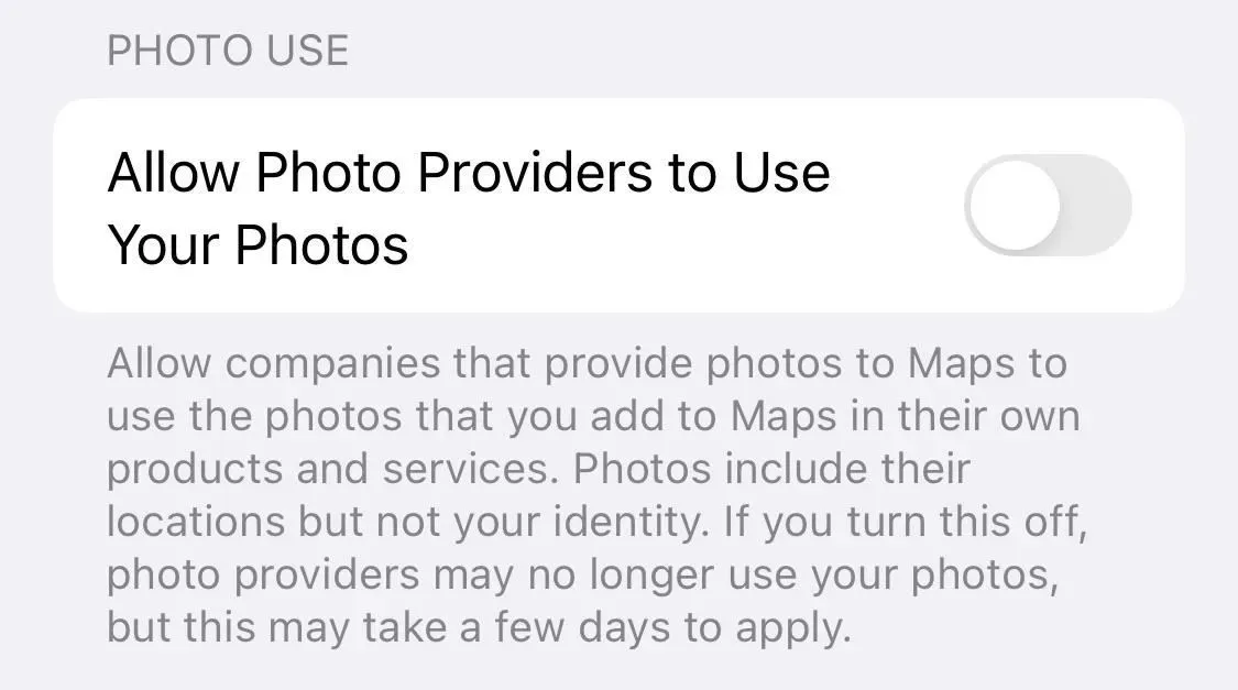
9. Allow businesses to use the photos you upload to the cards
In Settings -> Maps, you’ll find a new “Allow photo providers to use your photos”toggle to allow or prevent businesses from using the images you upload to Apple Maps in their products and services. For example, if you upload images to a restaurant page, businesses like Yelp can use those images in the Yelp app if the toggle is enabled. The switch is off by default.
Allow companies that provide photos to Maps to use the photos you add to Maps in their products and services. The photos include their location, but not your identity. If you disable this feature, photo providers will no longer be able to use your photos, but this may take a few days.
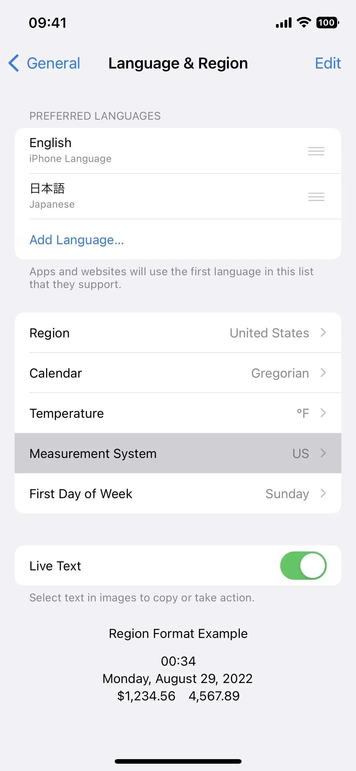
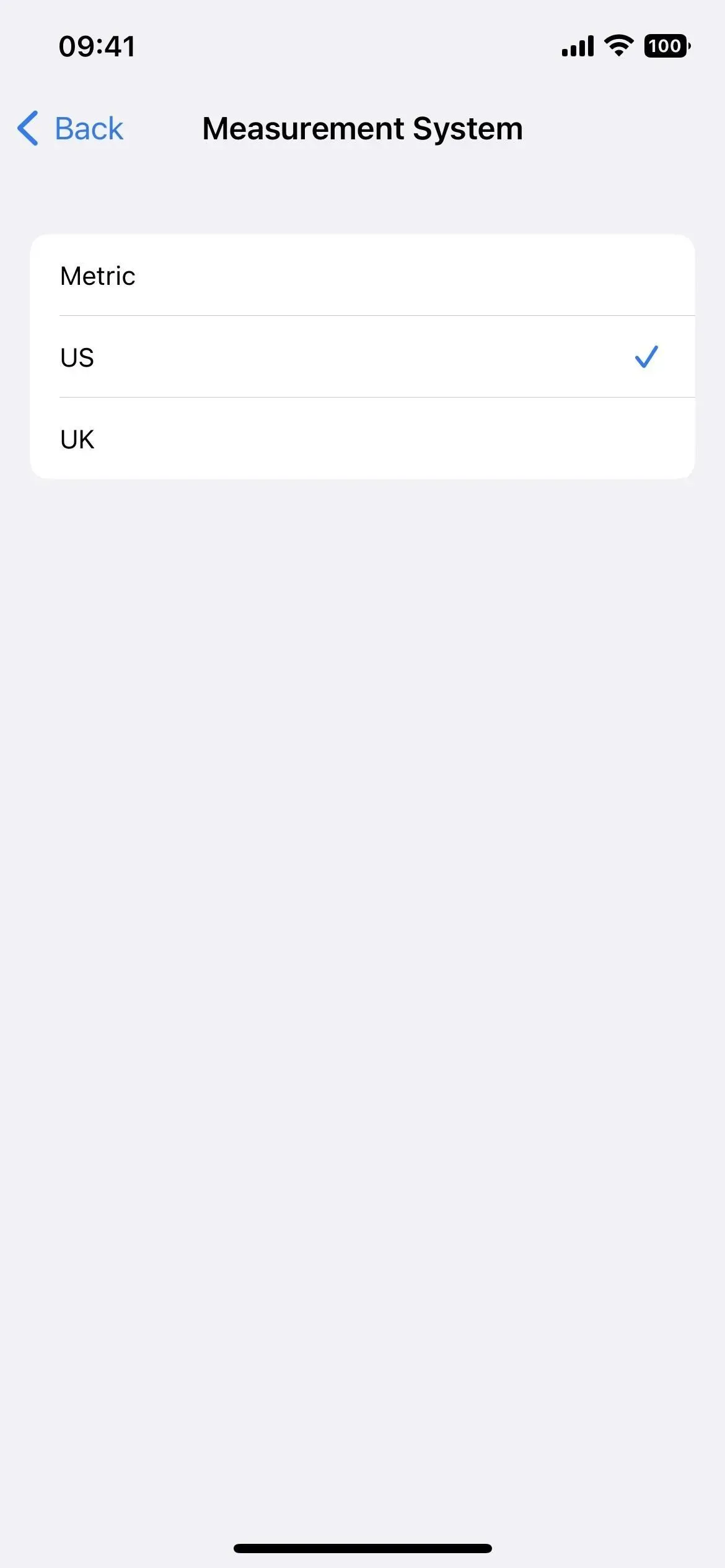
10. Miles/Kilometers settings changed
In iOS 15 you could go to Settings -> Maps and there would be a Distances section where you could choose between Miles and Kilometers for everything in Maps. This is no longer available in the Maps settings. Instead, you can set it as a device-wide preference via Settings -> General -> Language & Region -> Measurement System.
11. More countries get better maps
In 2018, Apple began updating the Maps app with “faster, more accurate navigation and a comprehensive view of roads, buildings, parks, airports, shopping malls, and more,”a slow rollout around the world. It took Apple until 2020 to update everything to updated Maps in the US, and other supported countries include Canada, Germany, Ireland, Italy, Portugal, Singapore, Spain, and the UK. Now iOS 16 introduces the new design in 11 more countries:
- Belgium
- France
- Israel
- Liechtenstein
- Luxembourg
- Monaco
- Netherlands
- New Zealand
- territories of Palestine
- Saudi Arabia
- Switzerland
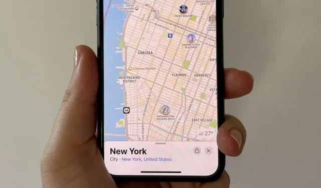
12. More cities get detailed experience
Prior to iOS 16, Apple Maps had only ten locations with detailed city descriptions. These features give you 3D maps of the entire city with improved navigation, immersive AR walking routes, driver’s windshield views, and detailed information such as road markings, land cover, trees, elevation, and public transportation routes.
These cities include London, Los Angeles, Montreal, New York, Philadelphia, San Diego, the San Francisco Bay Area, Toronto, Vancouver and Washington DC.
Now seven more cities will receive 3D maps and an improved interface, including:
- Atlanta
- Chicago
- Las Vegas
- Melbourne
- Miami
- Seattle
- Sydney

Image via Apple
Leave a Reply